Q&A - What do the Police Think about Heavy Trucks?
 I drive a semi tractor trailer for a living. I was wondering what cops' take is on slowly rolling through a stop sign at 5 kph, after scanning the intersection in a rural area and seeing no traffic.
I drive a semi tractor trailer for a living. I was wondering what cops' take is on slowly rolling through a stop sign at 5 kph, after scanning the intersection in a rural area and seeing no traffic.
 I've always wondered how well the underride protection at the back of heavy commercial trailers would work, but I was never called on to investigate a collision like this. The Insurance Institute for Highway Safety (IIHS) has produced a video that shows these underride prevention structures provide poor protection when built to US standards and only slightly better protection when built to Canadian standards.
I have a question regarding driving violation 214.1(1) prohibiting cell phone usage while driving. I recently was pulled over by an RCMP officer and when I asked what was wrong he said that I had been using my cell phone while driving. I tried to respectively deny this as I had not been using my phone.
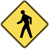 As a pedestrian in Vancouver I am feeling increasingly at risk. Cars making left turns are a particular hazard. To get to work I need to cross Cambie St. at 57th, where there is a pedestrian controlled crosswalk. I think that there needs to be more awareness around this kind of intersection.
Maybe it,s just me,but if I was walking somewhere,and someone came up behind me with a wepon (gun,knife,ect).and beiing trained in martial arts,It is my right to defend myself,,,as my life is at risk..I would be concidered somewhat of a hero,if I sucseeded to aprehend this criminal. If I did,nt sucseed,,Yes I could be dead or injured,,but at the time,,the choices beiing???????
 What are we thinking about when we drive? More and more often I am convinced that we are thinking about anything but the driving task. Please be assured that when I say this I am giving drivers credit that they know how to drive properly in the first place.
![]() Are you curious about where and why crashes are happening in your community? ICBC's crash maps allow you to access the most recent five years of data for our province arranged by municipality or by areas of special interest such as cyclists or pedestrians. If you are ambitious, you can even create your own views by applying filters to the data.
Are you curious about where and why crashes are happening in your community? ICBC's crash maps allow you to access the most recent five years of data for our province arranged by municipality or by areas of special interest such as cyclists or pedestrians. If you are ambitious, you can even create your own views by applying filters to the data.
 I'm not sure if you have covered this in previous columns but two of my biggest peeves is people that can't maintain proper lane positioning and people that shave corners. This is extremely dangerous if the offending driver is coming into your lane and a friggin' nuisance when following behind someone that 'gets into the gravel" and spits it up. What happened to the drivers courtesy today?
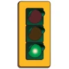 A green light doesn't always mean go unless you've had a good look to make sure that there are no hazards present before you proceed. Jennifer Biggers learned this when the vehicle she was driving collided with Carol Murdoch, who was crossing quickly in a marked crosswalk against a red light at the intersection of Blanshard Street and Saanich Road in Victoria.
My girlfriend used my car last night and was caught speeding. Besides the ticket, my vehicle was impounded for 7 days. I was out of province and returned today and now can't get to work. So... How is this my problem?
My car is insured, she has a license and was fined as well. She drove her car to pick me up.
She still allowed to drive but I can't?? This is absurd.