VIDEO - Cannabis & Collisions: Dr. Jeff Brubaker
 Webinar hosted by the BC Injury Prevention Unit and conducted by Dr. Jeff Brubacher, Associate Professor, Dept. of Emergency Medicine, University of British Columbia. Unfortunately, the video sound is poor.

 The case of
  "Are there rules for riding bicycles?" a reader asks after narrowly missing a collision with a bicyclist. "They seem to ride wherever they feel like it. How is a driver supposed to know what bicycle riders are going to do?"
 A common message that arrives in the DriveSmartBC inbox concerns the perception of a local problem and either no response or an unexpected response from local government. The writer is usually looking for someone to solve their problem for them with little or no effort on their part beyond the initial complaint. Chances are excellent that the problem will continue to be a problem unless there is a concerted effort to resolve it.
 The
The  Every year an average of
  The majority of all traffic collisions occur in the urban environment, where there is a more complex traffic environment and a higher predominance of road users that are more susceptible to injury and fatality in the event of an accident. A relatively straightforward and cost-effective speed management measure, involves reducing speed limits.
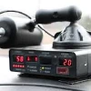
 "I want to see my speed reading!" This was always a signal to me that the traffic stop was going to be a difficult one. The demand for a print out of the radar reading was a similar request. Depending on the tone of voice, it was often simpler to refuse outright and explain later on in traffic court, letting the justice be the referee.
